Out of the Lairig Ghru

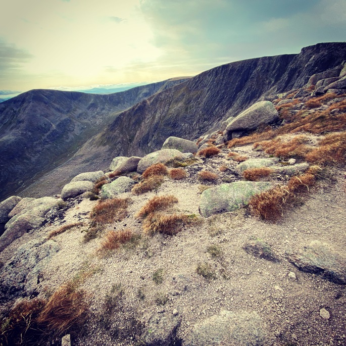
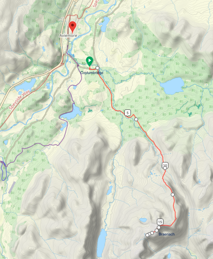
It was sad saying goodbye to The Angel’s Ridge, and it didn’t take too much time to pass by The Devil’s Point and leave the southern jaws of the Lairig Ghru behind. I had plenty of food and supplies, to wander around the different summits, though for some reason I decided to head pretty much directly south, along the river Dee on the valley floor.

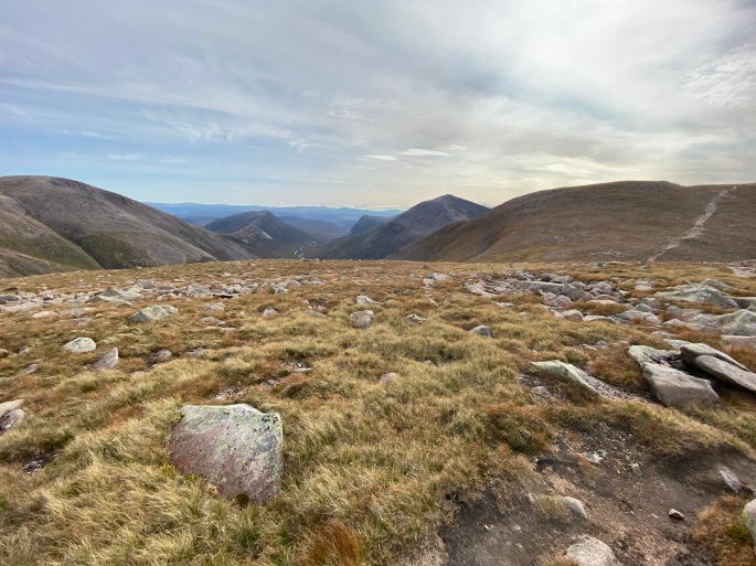
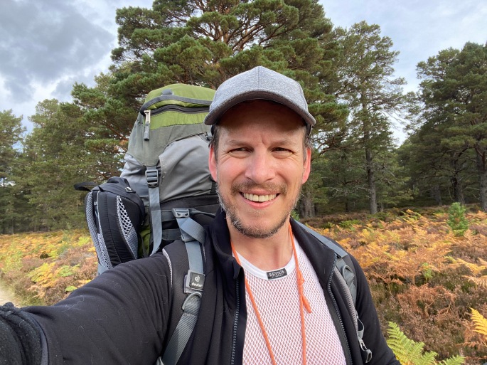
Heading this direction and I knew it wouldn’t take too many days to get towards Blair Atholl and it would be pretty flat. I figured that I would be able to make diversions up the different mountains along the way as and when I felt like it. At the same time, I was constantly feeling the rucksack on my back, which I probably wasn’t in the shape I should have been to be carrying such heavy baggage, and still feeling the first day’s climb up Braeriach. The idea of more climbing wasn’t really too appealing. It was just nice walking at a nice and steady pace and taking in the splendid views with the dramatically cloudy sky without feeling too much pain in my legs!

The path down…

Just a quick note about the path down from the Angel’s Ridge to the Corrour Bothy. Very steep – definitely glad that I was walking in decent conditions; if it had been wet, it might have been a bit more treacherous. On the map, you can see the tight contours and the way the path winds down, but I was always curious about how it would be to be on it. It crossed over a stream/light waterfall near the top, and I guess the longer steps down meant that my knees felt it a little bit more, but ultimately it was okay. I can imagine it would have been quite a tiring climb up – exhausting with a fully loaded rucksack. While I was there for a challenge, I am glad I didn’t opt to go that way–going up Braeriach the “easy way” was tiring enough and as I say, I still wasn’t at 100% fitness!

Appearances can be very deceptive. Can see the top of the path just left of middle in the picture by the stream that cuts down from the ridge. It’s difficult to see how steep it was.

Getting to the bottom and you can just about make out the top section of the path before it’s obscured by the lower hills, but as well as the welcome site of the bothy, the dramatic view of The Devil’s Point proudly towering up and looking down on everything was worth it. Really would love to have done the hike in winter–more preparation for the future polar journeys, and they say the Lairig Ghru is great for Arctic training given the tundra-like conditions in winter. But the lockdowns now have made that impossible this year at least. Will go back in spring/summer when the restrictions have eased and see where I am next winter considering training will be ramped up for the Greenland expedition, but for now I have to content myself with looking at the photos and dreaming myself there.

Corrour Bothy with The Devil’s Point towering above

Back to Angel’s Ridge

To be honest, when I camped for the night when I came down from Braeriach, I was expecting quite a storm, but while it was a bit blustery and wet, nothing really materialised. The morning after and it had all cleared up and it was lovely. Just sporadic cloud in the sky, cool with a nice breeze. Perfect.

Nice start to the day
Another four Munros!

After my customary breakfast of porridge with strawberries, I broke camp at a respectable time of 9am, and decided that I would take in a few more Munros to compensate for the previous day’s modest distance. First, Monadh Mor at 1,113m, which was a reasonably straightforward climb up from my camping spot. This had a splendid view across the valley to the Angel’s Ridge and the rest of my day’s trek, first with Sgòr an Lochain Uaine (aka Angel’s Peak – 1,258m), then Cairn Toul (1,291m) and finally Stob Coire an t-Saigdeir (1,213m) before heading down to the floor of Lairig Ghru to pitch tent by the Corrour Bothy. Bothy’s are great, but I prefer the tent as easier to warm up, and just habit. Besides, with COVID, didn’t feel comfortable staying in it (it was meant to be closed but it wasn’t).

A tiring day, though nothing that was really hard or treacherous. Lots of climbing and descending between the peaks, and spectacular views over the surrounding mountains. Thought about doing a “quick” climb up The Devil’s Point, which towers up at the south-eastern end of the mastiff, but it was starting to get late and my feet were tired. If there was anything I had learned over the past couple of days, there was nothing “quick” about trekking. Even if a peak looked close on the map and it didn’t look to be a massive climb, the distances and the climbs involved were always so much harder than the seemed. The rucksack was hardly getting any lighter.

Highland weather

One of the very many reasons why extreme altitude mountaineers love the Highlands–aside from the spectacularly beautiful landscape, which goes without saying–is the way the conditions can change so quickly. One moment you have beautiful weather, then the next, the cloud has come down and the wind has picked up. It’s challenging. One of the aspects of the chapter I had come up to research for my novel touches on this and I was overjoyed in the way this happened to me on Braeriach. The day of my ascent started off perfectly–as I say, just beautiful. By the end of it, the wind had picked up, making it pretty tough to pitch the tent, and there were gales over night. It was my sister’s 3-season tent (my 4-season tent is in Canada – long story behind that), so I got a bit nervous about whether it would survive. Fortunately, it performed admirably.

A short hike down

The morning presented a completely different view. While visibility had been incredible on the climb up, in the morning, the entire summit was shrouded in dense cloud (though am sure it can get much thicker!). I thought about just staying there for the day, though there were weather warnings as well about stronger winds (I had an InReach satellite comms device so could stay in touch with people – really could not recommend more highly for any camping journey when out of mobile range). My sister was also worried about whether her tent could take it, so I decided to break camp and head lower, wearing a nice bright rain/wind jacket–keeping in mind that a little to the east there were rather steep cliffs that bordered the An Garbh Choire corrie (can see more of this and other amazing corries again on the Walk Highlands site!). The idea of falling down into that was not particularly attractive, so I headed down on the more gentle south-western slopes to find a more sheltered camping spot, by a small stream well below the cloud cover.

Not the longest of walks in the world, but in the conditions (amazing how easy it was to start wondering away from your desired heading in the cloud when took eyes off of the compass), weight of the rucksack, and the tough hike up on the previous day, it was fine.

To Braeriach

The route from Coylumbridge, just outside Aviemore, to Braeriah

One of the more productive things that I managed to do when I was stuck in the isolation of the lockdown in New Delhi was actually, over the period of five months, write a first draft of a novel I had been thinking about for sometime. Was pretty pleased with myself – you know when you have lots of ideas but they don’t connect? Well, I managed to work out how to bring them together within a nice structure and the writing just kept on flowing. The reason I mention this is that one of the chapters is based up in the Highlands, and specifically the Angels Ridge and the second highest mountain in Scotland, Braeriach. One of the reasons I wanted to train in the Cairngorms, and more specifically, start from Aviemore, was that Braeriach is less than a day’s hike from the town, and I wanted to see how accurate my descriptions were considering I had never been there and had been relying on the photographs of others and Google Maps to try and gauge what it might be like.

Towards the Lairig Ghru. Ben Macdui–the second highest mountain, just a few metres taller than Braeriach, can be seen ahead, while Braeriach, which is just across the glen, is obscured by the trees on the right

It didn’t disappoint and was a tremendous start to the next few days of hiking. My rucksack was ridiculously heavy, laden with plenty of supplies, though part of the whole challenge was also to cope with the weight on my back! The first 10km were pretty flat, easy and again in perfect clear conditions. Walking along a forested path that gradually opened out to just heather and to reveal the mountains of the Lairig Ghru, including Braeriach, before me. Even had more chance to mess around with the drone. But once the ascent started… wow! The next 5km up from 600m to almost 1,300m. Tiring and, on the steeper parts, painful! Plenty of other hikers passed me on the trail as I just slowly made my way up, and there were so many false summits before finally making it.

I had originally aimed to go around 25km to get to the bottom of the Angel’s Ridge, near Devil’s Point, but by the time I got to the summit, after around 16-17km, I was getting a bit tired and it was getting a little late so decided to pitch the tent just a little further along next to the Wells of Dee – the source of the River Dee, which flows through to the sea at Aberdeen, where I was born. Thought there was some nice poetry there! Nice to finally be out in the tent as well, and it definitely was worth it just for the chapter.