Ben Weber relaxing in tent antarctica

Day 9 A slow and painful 10k

10k/6.2miles

But at least it is another Antarctic 10km done!! Today was always intended to be a shorter day considering the pains over the last few days. I wanted to see how I’d be able to get on with the neck and how the neck would react to more exertion. At the same time, I didn’t want to overdo it and hurt my muscles even more than they have been.

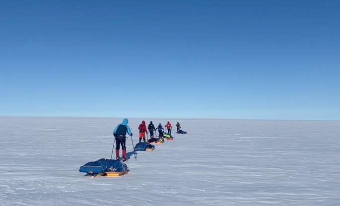
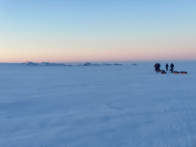
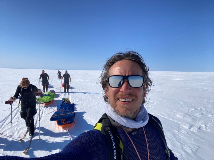
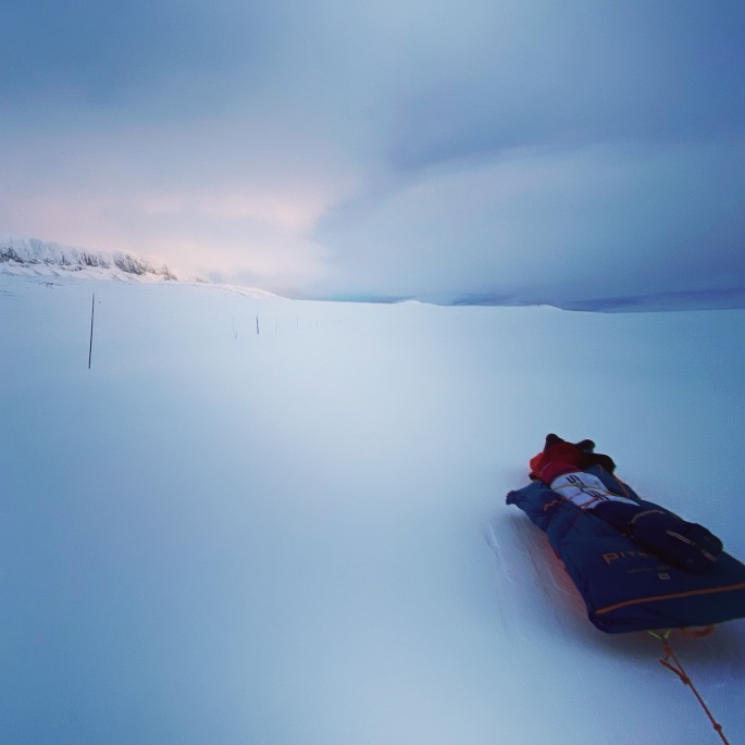
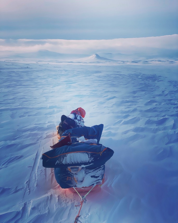
So, after speaking one more time with the doctor in the morning, I set out at around midday. Complete whiteout for the most part – low cloud meant that only very diffuse light was getting through making it hard to see the obstacles (sastrugi!!) in my path. Fortunately, the sastrugi seem to have eased somewhat; they are smaller than earlier and less prevalent, which is a relief. It still meant also navigating by the compass and using the wind. I am currently wanting to go south southeast and the wind is coming from the southwest, so just keeping the wind coming across from my right helps keep me with the right heading. The cloud also eased a bit towards the end of the day which helped a bit.

Progress was certainly slow. I had to stop every couple of hundred metres or so to try rotating my head around, up and left and down and right; repeat a few times and reverse. It did kind of help. It meant that by the time I did stop to camp at around 6pm I wasn’t in agony this time… which was a welcome relief. Still painful, just not quite as bad!
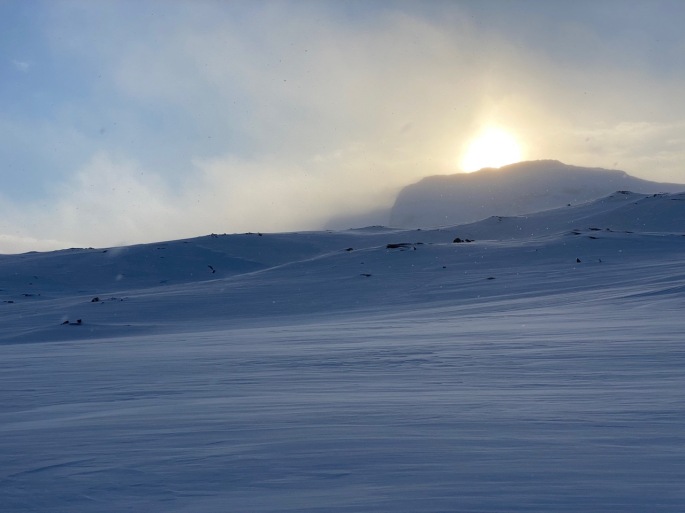
Storm on its way

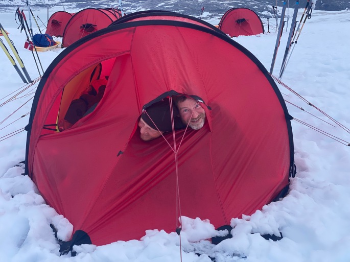
So, I have had my evening call with the people at base. I need to come in further east as am quite near a crevasse field to my southwest, but am just about okay where I am. There is also meant to be a storm coming in over next couple of days, with winds getting up to around 100kph. Good test for the tent! And maybe a bit more time for the muscles to recover as it would be dangerous to ski in such conditions!

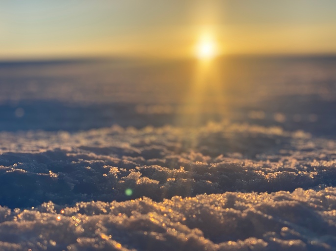
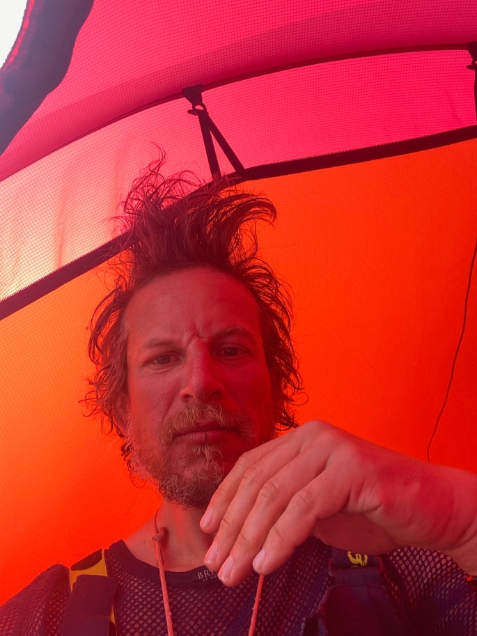
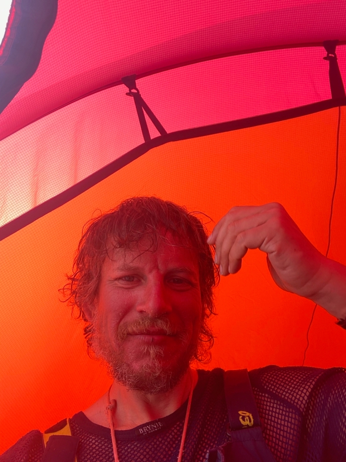
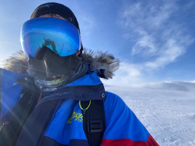
After note: And now, at 11pm, the sun is bright and high in the sky, making the tent feel so warm; like a greenhouse! Just the wind blowing though it’s easy to forget how it’s -20c outside at the moment!!

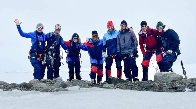
Please support Ben’s chosen charity Cancer Research UK

Click on the tracker below to hear Ben’s audio diary from his overnight camp.

Antarctica: Preparations and delays

The journey to Punta Arenas

It has been a long couple of weeks or so. On the 28th October, I started the journey south from Inverness, making sure to have a couple of days in Oxford and London to see friends and family before heading to Punta Arenas in Patagonia, which is my base before flying to Antarctica. The journey to Punta started on the 1st November and was reasonably smooth though not without worrying moments.

The staff of LATAM Airlines in London told me my bags would go straight through to Punta. This struck me as unusual as was flying through Santiago: normally you must collect bags at Santiago to clear customs. In Sao Paulo (where I had a 12 hour layover), a LATAM rep told me that I indeed needed to collect the bags. Talk about making life confusing! At Santiago, the bags didn’t appear.

After waiting an hour to speak with the LATAM baggage claim people, they told me they didn’t know where the bags were. But yes, they said: I needed to collect them to clear customs there. Fortunately, given another huge layover (8 hours this time), there was time for them to find them, and all was good. Alarming, but it worked out! It was nice to pick them up as well as I had left my laptop in the checked baggage (long story!) but that was there and undamaged.

Getting it all sorted

Finally, on arriving in Punta Arenas at around midday on the 3rd, I got to the hotel. I am staying at the Apartment Hotel Quillango. It is a nice place, close to the centre and with space to organise everything. Definitely needed as there was so much to organise! Antarctic Logistics & Expeditions (ALE) – the company that organises the logistics for Antarctic journeys – delivered my cargo to the hotel. The Pulk, food, skis, tent, electronics, clothing and more: everything together under one roof for the first time.

Then it was a matter of decanting 155 dehydrated dinners, lunches and breakfasts (Expedition Foods) from their pouches into lighter bags. This is a time-consuming process but it reduced the total weight by 3kg. It also means that I need not worry about accumulating residual waste in pouches after eating, which adds weight. Every kilo counts on an Antarctic expedition!

Also, I had to sort out my daily snacks of chocolate, dried fruit, nuts, protein and energy bars, cookies and crackers, and meats and cheeses, into separate bags. Buying and cooking the meats (sausages, bacon, ham, chorizo and salami) and weighing everything out into the ration packs. It all took about three days or so.

With everything now packed and organised, it’s just a matter of waiting. I was meant to fly to Antarctica on 10th November. However, a harsh winter has affected ALE’s base on the continent and delayed all expeditions. A massive amount of snow has accumulated on the runway making it impossible for large planes to land, and poor conditions are hampering the opening of the base. My flight is now set to the 13th, thought this might be delayed further. Fingers crossed I can get going soon!

Getting the pulk…

The pulk (the sled) is pretty important for the entire journey. I will be pulling all my food, tent and equipment, fuel and clothes it and at the start of the South Pole journey, it will weigh around 110kg or so. So it’s got to be pretty sturdy!

In Greenland, where we were pulling around 80kg or so, we used two Paris Pulks each. These are decent in that they are not very expensive, though as they are quite short, it was impossible to put everything onto just one of them. One of the big disadvantages of the Paris Pulks is that they are quite shallow and it is easy for them to become top-heavy and topple over to the side. You also have to have separate bags with all your gear and food that you secure on top of them with bungees or some other means. If you don’t pack your bag properly each morning, then you’ll be in for an annoying day having to go back and forth to the sled to turn it the right way up over and over again. Also, when the wind gets very strong, it can simply push the pulks over, and in Greenland we had to put the two pulks parallel with each other for a few days to stop that from happening.

Everyone on the Greenland expedition used Paris Pulks. You can see how say with the person at the back, the green bag that has the bedding is leaning over to the side. This happens a lot when you’re securing all the bags to the sled by the bungees, and it all affects the balance of the sled and how you move along.

So for the South Pole journey, I have got myself a nice gigantic IceTrek Polyna sled. 210cm long, 68cm wide and 25cm deep (without the cover). Made by fantastically experienced polar explorer Eric Philips, they have a tremendous cargo volume and are designed to effectively float on soft snow and glide along nicely on the ice. Shouldn’t have any problems of overbalancing! I had arranged with Eric to pick the sled up in Svalbard (long story!)… quite an epic journey to get there and back… Inverness-London Luton–>London Heathrow-Oslo-Longyearbyen-Oslo-London Heathrow–>London Gatwick-Inverness… 6 planes, 6 different airports, 3 trains, 3 buses, 3 taxis, 2 days! Was kind of worried after collecting it that it might be too big for the airlines, and trying to cart it through the airport on the trolleys was pretty tricky given it’s length, but fortunately no real problems in the end! Tiring though.

Just a note: am (trying to!) raise funds for Cancer Research UK with these expeditions – please donate if you can, or share if you can’t!!! It would be amazing to have your support!

Polar diet and nutrition

There are so many details to think about with any polar expedition, and a lot of planning is required. One of the most important aspects is the diet. For the expedition to the South Pole, I will be burning around 7,000-8,000 calories a day and the body will need a massive amount of food and energy to make sure that it is able to cope. To manage, you have to have a substantial breakfast, then regular breaks during the day: in Greenland we would ski for 50 minutes and then take a 10 minute break to eat snacks and drink water. This would be over (on average) nine sessions a day, occasionally increasing to 10 or 11 sessions when needed to make extra distance. In the middle of all of that we would take a half hour break to have lunch. On previous expeditions, I have not had the lunches: I just had snacks every hour or 90 minutes… It was fine and both Natalia and I never felt fatigued doing that, but I felt in Greenland, having an actual lunch helped break up the day and gave an extra boost. Ultimately, you get into a routine, and need to find one that suits you and plan accordingly. You have to eat, as while you might feel good, your body demands it.

You can’t just eat energy bars and chocolate and you need variation, especially considering the endless routines being repeated over, in the case of the South Pole, around 45-50 days. It would be a good high energy breakfast such as porridge or granola. During the day, the snacks would consist of nuts, dried fruits, chocolate, granola and protein bars, cookies, a bit of meat and cheese (though smaller proportion as the body will need much more carbs than protein). This all has to be carefully weighed out for every single day, so you have your snack bags for each day ready to pack up. Then a nice dehydrated meal in the evening when camping. You can also add butter to the meals and breakfast for the extra calories and fats, and energy drinks and protein recovery drinks will also help.

I have tried various brands and types of camping foods on my different expeditions, and it really is important to have food that you like and a good range of flavours to have the variation. You don’t want to be dreading your evening meal or your breakfasts, and variation to the daily snacks also helps to enjoy everything, so you can add little treats into your bag. You want to plan out each week to know what you will eat, and have everything in the weekly stuff sacks. For South Pole, I will have stuff sacks for every 10 days… which week days won’t really mean anything down there!

My favourite dehydrated food over the different journeys I have been on has been the meals made by Expedition Foods. They really do make a great range of different meals (Fish and potato with parsley sauce, and their spaghetti bolognese are among my favourites, but there are many others!) and I was really delighted when they agreed to support the coming South Pole journey. 50x 1,000kcal evening meals, 50x 450kcal lunches, 11x 1,000kcal breakfasts (I have a standard maple syrup flavour porridge that I came to love in Canada!)–the Expedition Foods breakfasts will make a really nice treat between the standard ones!–and 10x 450kcal dessert… again, to make for occasional treats to help the motivation and enjoyment.

Greenland Part 5: The final push

We were lucky with the weather and conditions over the full course of the journey. A couple of days’ worth of total whiteouts made navigation a little tricker, with some… interesting diversions from the main course witnessed… and also a couple of days with colder temperatures and stronger winds. Winds that meant we had to put our sleds parallel alongside each other rather than one behind the other as otherwise they just got blown upside down. One day saw a windchill factor of around -39C, making it slightly harder to ensure that our fingers stayed warm. I was pretty happy that managed to keep everything reasonably under control, though had to move from my lighter mittens to the big down-filled mitts to make sure that stayed okay as I could feel the fingers getting colder as we travelled. They took longer than what I would have liked to warm back up. On previous nights in the tent it had been warm enough to fire up the stove and eat without gloves, but our fingers quickly became numb when doing that as the temperatures plummeted. Definitely nice to get in the sleeping bag at the end of a long day!

Our daily distances started to increase further as we started the slow descent from 2,500m. The sleds had become lighter as we ate our way through our supplies and our best day was around 35km or so as we skied for around 11 hours. Fortunately, we didn’t have to have any other long days and we generally managed 30km or so on normal 9-hour days without too much effort. The plateau was so high, we couldn’t see any of the eastern coast mountains for many days as they were all much lower than where we were skiing. They only started to reveal themselves about two days or so before we reached the end. It was a big moment as we saw the first summit peaking up in the distance ahead of us. Then it was just amazing seeing more mountains appearing as we got lower and lower, and then seeing the coast and all the sea ice and icebergs floating their way calmly along through the water.

For the last night on the icecap we camped around 35km away from the end of the glacier at around 1,200m. We didn’t want to camp further down due to the risk of crevasses. We knew that snow was due to start mid-afternoon the following day so we started our final descent at 2am to have the best possible visibility. And it was stunning. Breathtaking views of the mountains on the other side of the glacier and the sun rising, and great skiing conditions. Before we knew it we had already completed 20km in time for lunch. Almost straight after we ate, however, we entered pretty dense cloud making it harder to see the best path, and we entered a maze of melt water channels that took a while to escape from. Narrow paths alongside deep chasms where the glacial melt water would flow as the temperatures increased; not places you would like to fall into. We tried to work our way through to a waypoint which had been clear on previous years, but it was impossible to see through the cloud and eventually we had to turn back and try a different way. Fortunately with the second route to a different waypoint, it became clearer and safer, and again it was full speed ahead and before we knew it, the end of the glacier and the end of our expedition was ahead of us… We had done it!!!

Only not quite..!

We were meant to get picked up by helicopter from that ending point but the bad weather meant that it was cancelled for three consecutive nights… frustrating!!! But we were able to make the most of it, despite it raining and being pretty miserable at the bottom, having sing-alongs between the different tents and relaxing as much as we could, with one of us always on polar bear watch (seeing polar bear tracks before arriving helped enforce the need for that!). It was difficult though after having been on the move for so long and having been looking forward to celebrating in Tasilaq where there was good food and drinks waiting for us. For the third night, rather than staying put yet again, we decided to ski down to the fiord and on to the sea ice, up to the edge of the water, and were picked up by boat. It wasn’t possible to go to Tasilaq but they took us to Isertoq where it was nice to actually have a night inside and celebrate the journey before getting finally picked up by the helicopter in the morning. This time, we had done it!

Greenland Part 2: Speeding up…

We started the expedition off slowly: three 50 minute sessions on the first half day with 5km travelled, then doubling to six sessions on day 2. Following this we added an extra session each of the next three days, until we were travelling nine sessions over the course of each day. We didn’t want to go all-out straight away due to risk of injury and we wanted our bodies to adapt to the demands of the expedition. While we had all been training hard, it was still important to be careful.

At the same time, the terrain of the icefall didn’t allow us to move very fast as we were snaking around and looking for the best ways through for quite some time. Indeed, we took three days to get through this part of the challenge: the ice ridges slowly became less prominent, the chasms became shallower and the crevasses became fewer and farther between. It turned into an undulating landscape of smooth snow and ice in all directions. As the landscape changed, our speed increased: more than doubling from 8km travelled on day 3 to 18km on day 4 and increasing up to 24km by day 6.

It would be easy to describe the terrain as featureless but that would be unfair: the glorious weather and the sun sheds all sorts of characteristics to the ice that help catch one’s attention. And we had wonderful weather with bright sunshine, clear skies, and temperatures that hovered around -10C for a good week or so. The conditions were so good, we were skiing in our base layers, and even able to have a dinner as a group outside of the tents on one of the nights! In these conditions, the randomly scattered rougher and exposed ice could be clearly seen, making navigation straightforward as we could use them as reference points for our headings. At the same time, the eyes could play tricks: we could see what looked to be steep snow walls in distant hills though as we got closer, the slopes were barely noticeable. As an added bonus – we even saw a flock of geese migrating west on one of the earlier days. Just imagine the distance they have to travel!

It was quite amazing and a privilege being in the middle of all this; the serene and pristine environment that just took our breath away. Being here and the mind also goes on its own journeys as we listened to the sound of our breathing and the skis. It’s tough, but it’s all so peaceful at the same time.

Greenland – Final countdown and preparations

March-April 2022

With all the fitness training over the past few months, time really did seem to fly by to the end of April when we eventually started the journey across the icecap. So long in the waiting, but still always training as much as possible to be in the best possible shape for the journey; trying to squeeze in as much as possible but not to overdo it. More mountains climbed in Scotland, plenty more tire-pulling and lots of strange looks from people. Braeriach, the third highest in the country, is always an amazing mountain to climb and is quite accessible for me from Carrbridge, and it becomes even more stunning with the snow. Also, an opportunity to climb Ben Nevis in winter could definitely not be missed and it was nice climbing the UK’s highest mountain in cool and lovely conditions.

Before we knew it, the time had come. 25 April: Inverness to London, to Copenhagen. 26 April: Copenhagen to Kangerlussuaq. Always that anxiety about whether the bags would come through–imagine that! One flight to Kangerlussuaq every couple of days… no, it was too terrible to think about…! Fortunately they all came through and no problems. It was great in Copenhagen with the hotel being next to the airport – could take the trolley from the airport all the way into the hotel room; not seen that before! Quite a change from Oslo when there are barely any trolleys at the main railway station!

We had one night in Kangerlussuaq to organise all of our supplies for the next four weeks, splitting everything into weekly bags and sorting out the pulks. Had a bit of a scare when realised that I didn’t have my mountaineering harness, which we need for going through crevassed areas. Almost a disaster, though fortunately we we were able to find one from a local guide – such a relief! Then that was it… just a bus ride to the bottom of the glacier on a gloomy and overcast early afternoon of 27 April, and we were off…

Norway training Part 2: Preparing for Greenland and South Pole

With the ending of the group training with Hvitserk, I took the opportunity to go on my own solo journey around the Ustaoset and Finse region, and up to the Hardangervidda Plateau. With the South Pole plans at the end of the year, I aim to travel solo, so I need to have as much experience out by myself as possible. The journey to the Pole is not just physical, it’s also psychological – travelling alone for around 50 days, in the most extreme conditions, pulling the heavy weight of the pulk the entire time; the routine… every day, getting up, breakfast; packing up the sleeping bag and tent… skiing for the next eight hours or so… pitching the tent again; firing up the stoves and heating the water for food. Dinner and then sleep. And repeat. With nobody else around; just the satellite phone and locator beacon as your only means to contact the outside world a thousand miles away.

The Hardangervidda Plateau is a tremendous place to train. While the terrain is different from Antarctica – you have to ski through mountain passes and the wind is quite variable – the conditions can be formidable. I had a couple of storms with winds reaching around 70mph or so, and plenty of days with just constant strong headwinds. Then there were the whiteouts (I will write a separate post about them as you can say so much!!!), and travelling through deep snow, going up to your knees even with skis on that are meant to distribute your weight… and the climbing… It was tough! At the same time, with the tough conditions, Norway is wonderful because there is such great infrastructure. UT.no is a superb site that shows all the winter and summer trails (not in English, but it is easy to work out), and it also shows cabins where you can stay. You can use the site to easily plan out the routes you would like to take. From around early February people go out on their snow-mobiles to mark out the trails with long thin branches plugged into the snow as well, which would help anyone out there. The cabins were not open when I was there but if you join the DNT – like the backpackers association in the country (their website is also in English) – they give you a key that you can use to access the cabins in emergencies.

The second night out, I made a mistake with the tent in incredibly strong winds which led to some of the poles breaking… it was stupid of me, but I know what I did wrong and after repairing everything, it was nice for the confidence to be able to put the tent up again in similar conditions with no problem. Still hard when by yourself… so much harder than when with other people… but it’s something that I will have to deal with constantly in Antarctica. I won’t be able to just stay in the tent when it is windy – the winds will be merciless there! So ultimately, it was good to make the mistake in Norway where I could mend things and recover, to keep going. And ultimately, learn from what happened. It was a great feeling to arrive at Finse at the end of the time on the plateau having been able to work, navigate and travel through all those conditions, and it certainly helped build the confidence enough to know that with continued training, I’ll be able to manage on Antarctica. Exciting just to think about!!

Norway training, 2022: Part 1

For one month or so from the middle of January 2022, I went to Norway. First to meet with the group organised by Norwegian company Hvitserk with whom I will be going to Greenland, and then to go out by myself. The aim of the training: to get ready for both Greenland and the planned solo journey to the South Pole.

In going with Hvitserk to Greenland, I will be in a group of seven other people, including two guides. A nicely sized group and it was great getting to meet them all to go skiing with them and get used to the equipment we will be using on Greenland. So we spent a good four days or so, skiing around near Ustaoset, on to the Hardangervidda.

It was a good few days. Definitely felt the effects of not having skied properly for a few years–though am not sure if you can call my skiing “proper” anyway! I had only really been on the flat sea ice before this, and here we were going up and down these hills, which proved pretty challenging. I struggled quite a bit especially at first, trying not to fall over on the downhills, and going slower on the climbs up. But eventually I improved and wasn’t falling over too often when going downhill by the end of it! Uphills… it was varied. The snow can make such a huge difference. When there was slightly softer snow that wasn’t deep, it was fine. Though then there are times when it is really hard, wind-blown and compact, and it was difficult to dig the steel edges of the skis into it and get grip to go up, even with the skins on.

Then there was the time skiing across a frozen lake: rock solid ice with no snow cover on top and no way to get any grip with the skis. While I didn’t fall over, we crossed it in pretty strong head winds so occasionally I found myself actually being blown backwards! A bit frustrating and slow progress on that day, but good all the same!

Out of the Lairig Ghru

It was sad saying goodbye to The Angel’s Ridge, and it didn’t take too much time to pass by The Devil’s Point and leave the southern jaws of the Lairig Ghru behind. I had plenty of food and supplies, to wander around the different summits, though for some reason I decided to head pretty much directly south, along the river Dee on the valley floor.

Heading this direction and I knew it wouldn’t take too many days to get towards Blair Atholl and it would be pretty flat. I figured that I would be able to make diversions up the different mountains along the way as and when I felt like it. At the same time, I was constantly feeling the rucksack on my back, which I probably wasn’t in the shape I should have been to be carrying such heavy baggage, and still feeling the first day’s climb up Braeriach. The idea of more climbing wasn’t really too appealing. It was just nice walking at a nice and steady pace and taking in the splendid views with the dramatically cloudy sky without feeling too much pain in my legs!

The path down…

Just a quick note about the path down from the Angel’s Ridge to the Corrour Bothy. Very steep – definitely glad that I was walking in decent conditions; if it had been wet, it might have been a bit more treacherous. On the map, you can see the tight contours and the way the path winds down, but I was always curious about how it would be to be on it. It crossed over a stream/light waterfall near the top, and I guess the longer steps down meant that my knees felt it a little bit more, but ultimately it was okay. I can imagine it would have been quite a tiring climb up – exhausting with a fully loaded rucksack. While I was there for a challenge, I am glad I didn’t opt to go that way–going up Braeriach the “easy way” was tiring enough and as I say, I still wasn’t at 100% fitness!

Appearances can be very deceptive. Can see the top of the path just left of middle in the picture by the stream that cuts down from the ridge. It’s difficult to see how steep it was.

Getting to the bottom and you can just about make out the top section of the path before it’s obscured by the lower hills, but as well as the welcome site of the bothy, the dramatic view of The Devil’s Point proudly towering up and looking down on everything was worth it. Really would love to have done the hike in winter–more preparation for the future polar journeys, and they say the Lairig Ghru is great for Arctic training given the tundra-like conditions in winter. But the lockdowns now have made that impossible this year at least. Will go back in spring/summer when the restrictions have eased and see where I am next winter considering training will be ramped up for the Greenland expedition, but for now I have to content myself with looking at the photos and dreaming myself there.

Corrour Bothy with The Devil’s Point towering above

Back to Angel’s Ridge

To be honest, when I camped for the night when I came down from Braeriach, I was expecting quite a storm, but while it was a bit blustery and wet, nothing really materialised. The morning after and it had all cleared up and it was lovely. Just sporadic cloud in the sky, cool with a nice breeze. Perfect.

Nice start to the day
Another four Munros!

After my customary breakfast of porridge with strawberries, I broke camp at a respectable time of 9am, and decided that I would take in a few more Munros to compensate for the previous day’s modest distance. First, Monadh Mor at 1,113m, which was a reasonably straightforward climb up from my camping spot. This had a splendid view across the valley to the Angel’s Ridge and the rest of my day’s trek, first with Sgòr an Lochain Uaine (aka Angel’s Peak – 1,258m), then Cairn Toul (1,291m) and finally Stob Coire an t-Saigdeir (1,213m) before heading down to the floor of Lairig Ghru to pitch tent by the Corrour Bothy. Bothy’s are great, but I prefer the tent as easier to warm up, and just habit. Besides, with COVID, didn’t feel comfortable staying in it (it was meant to be closed but it wasn’t).

A tiring day, though nothing that was really hard or treacherous. Lots of climbing and descending between the peaks, and spectacular views over the surrounding mountains. Thought about doing a “quick” climb up The Devil’s Point, which towers up at the south-eastern end of the mastiff, but it was starting to get late and my feet were tired. If there was anything I had learned over the past couple of days, there was nothing “quick” about trekking. Even if a peak looked close on the map and it didn’t look to be a massive climb, the distances and the climbs involved were always so much harder than the seemed. The rucksack was hardly getting any lighter.

Highland weather

One of the very many reasons why extreme altitude mountaineers love the Highlands–aside from the spectacularly beautiful landscape, which goes without saying–is the way the conditions can change so quickly. One moment you have beautiful weather, then the next, the cloud has come down and the wind has picked up. It’s challenging. One of the aspects of the chapter I had come up to research for my novel touches on this and I was overjoyed in the way this happened to me on Braeriach. The day of my ascent started off perfectly–as I say, just beautiful. By the end of it, the wind had picked up, making it pretty tough to pitch the tent, and there were gales over night. It was my sister’s 3-season tent (my 4-season tent is in Canada – long story behind that), so I got a bit nervous about whether it would survive. Fortunately, it performed admirably.

A short hike down

The morning presented a completely different view. While visibility had been incredible on the climb up, in the morning, the entire summit was shrouded in dense cloud (though am sure it can get much thicker!). I thought about just staying there for the day, though there were weather warnings as well about stronger winds (I had an InReach satellite comms device so could stay in touch with people – really could not recommend more highly for any camping journey when out of mobile range). My sister was also worried about whether her tent could take it, so I decided to break camp and head lower, wearing a nice bright rain/wind jacket–keeping in mind that a little to the east there were rather steep cliffs that bordered the An Garbh Choire corrie (can see more of this and other amazing corries again on the Walk Highlands site!). The idea of falling down into that was not particularly attractive, so I headed down on the more gentle south-western slopes to find a more sheltered camping spot, by a small stream well below the cloud cover.

Not the longest of walks in the world, but in the conditions (amazing how easy it was to start wondering away from your desired heading in the cloud when took eyes off of the compass), weight of the rucksack, and the tough hike up on the previous day, it was fine.

To Braeriach

The route from Coylumbridge, just outside Aviemore, to Braeriah

One of the more productive things that I managed to do when I was stuck in the isolation of the lockdown in New Delhi was actually, over the period of five months, write a first draft of a novel I had been thinking about for sometime. Was pretty pleased with myself – you know when you have lots of ideas but they don’t connect? Well, I managed to work out how to bring them together within a nice structure and the writing just kept on flowing. The reason I mention this is that one of the chapters is based up in the Highlands, and specifically the Angels Ridge and the second highest mountain in Scotland, Braeriach. One of the reasons I wanted to train in the Cairngorms, and more specifically, start from Aviemore, was that Braeriach is less than a day’s hike from the town, and I wanted to see how accurate my descriptions were considering I had never been there and had been relying on the photographs of others and Google Maps to try and gauge what it might be like.

Towards the Lairig Ghru. Ben Macdui–the second highest mountain, just a few metres taller than Braeriach, can be seen ahead, while Braeriach, which is just across the glen, is obscured by the trees on the right

It didn’t disappoint and was a tremendous start to the next few days of hiking. My rucksack was ridiculously heavy, laden with plenty of supplies, though part of the whole challenge was also to cope with the weight on my back! The first 10km were pretty flat, easy and again in perfect clear conditions. Walking along a forested path that gradually opened out to just heather and to reveal the mountains of the Lairig Ghru, including Braeriach, before me. Even had more chance to mess around with the drone. But once the ascent started… wow! The next 5km up from 600m to almost 1,300m. Tiring and, on the steeper parts, painful! Plenty of other hikers passed me on the trail as I just slowly made my way up, and there were so many false summits before finally making it.

I had originally aimed to go around 25km to get to the bottom of the Angel’s Ridge, near Devil’s Point, but by the time I got to the summit, after around 16-17km, I was getting a bit tired and it was getting a little late so decided to pitch the tent just a little further along next to the Wells of Dee – the source of the River Dee, which flows through to the sea at Aberdeen, where I was born. Thought there was some nice poetry there! Nice to finally be out in the tent as well, and it definitely was worth it just for the chapter.