Greenland – A final word…

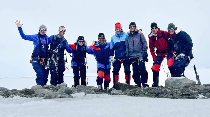
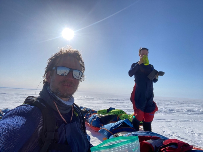
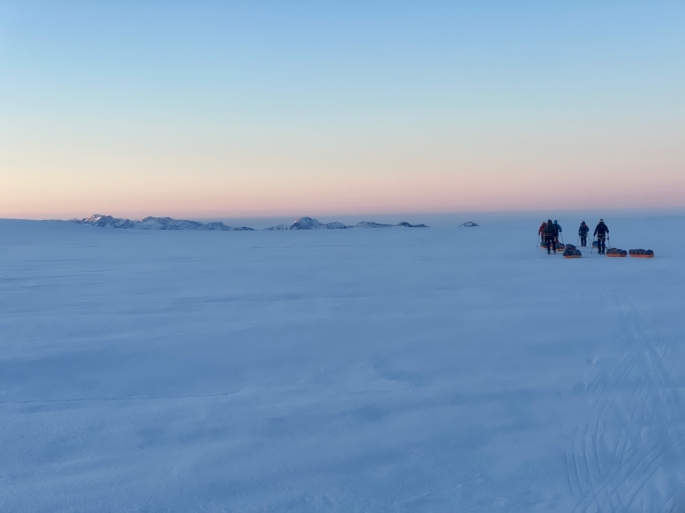
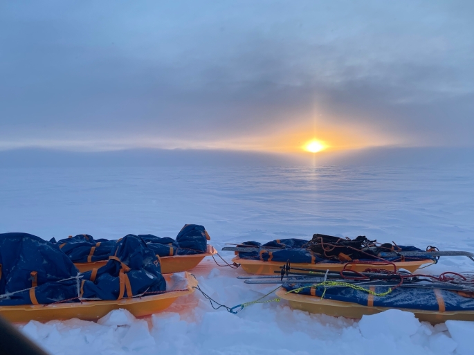
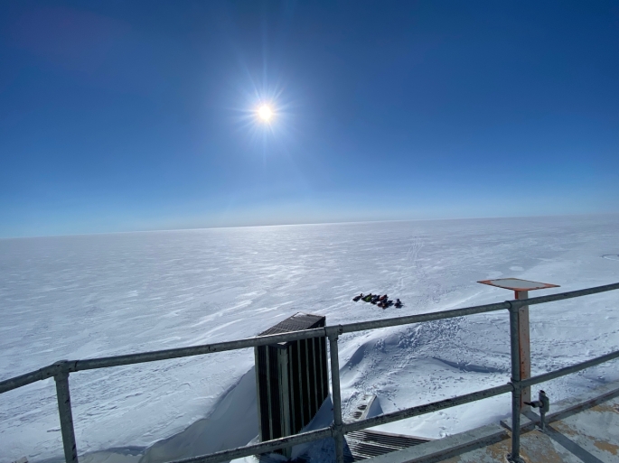
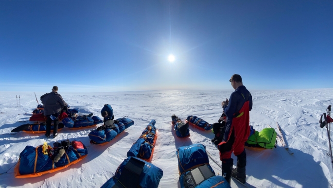
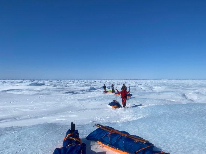
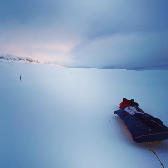
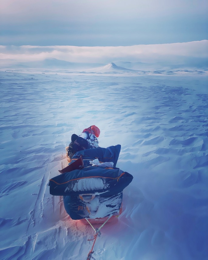
Travelling over 560km across Greenland with the Hvitserk group of seven other adventurers from Norway, Denmark and Sweden, was a truly fantastic and memorable experience.

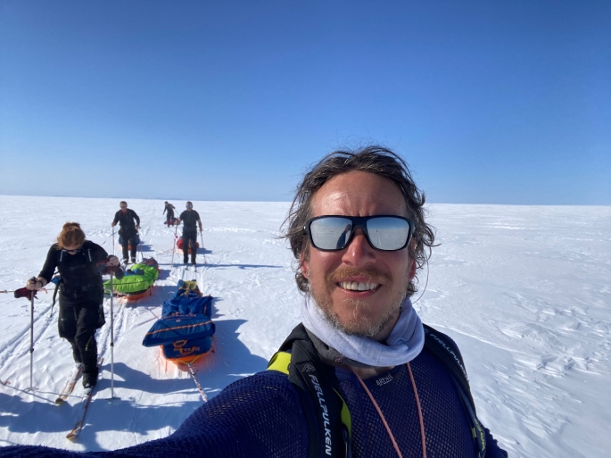
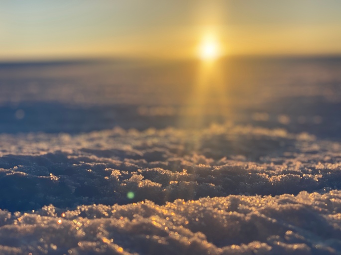
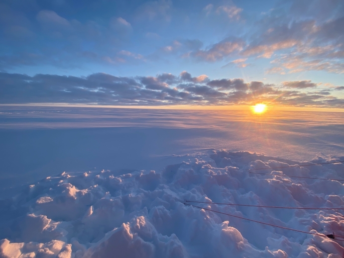
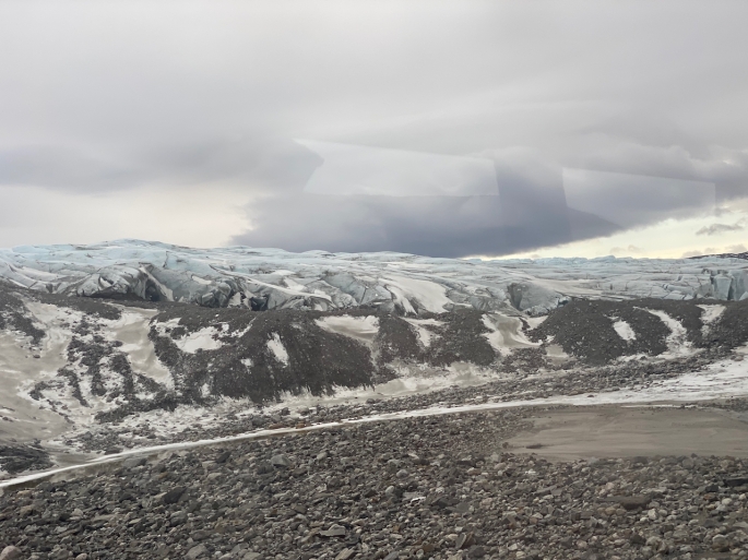
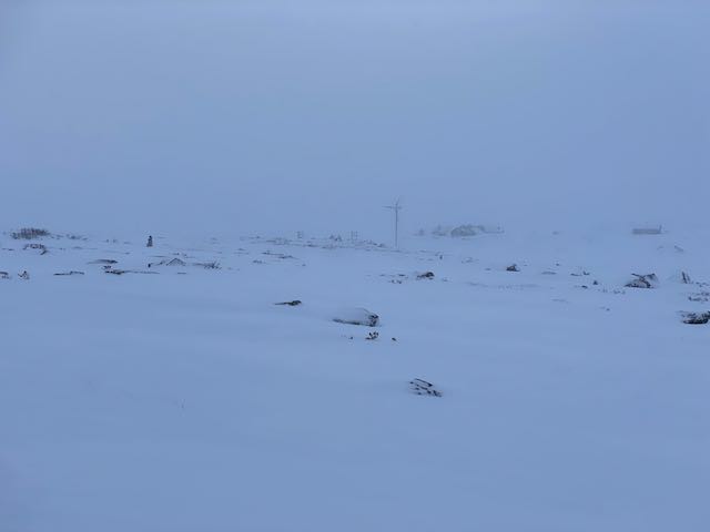
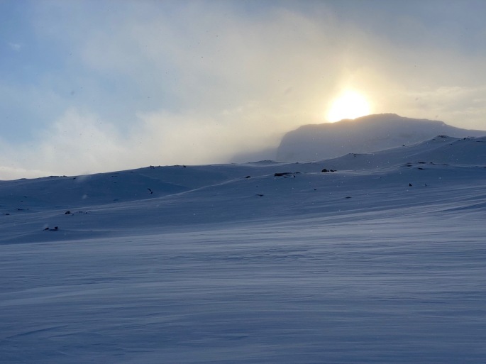
The whole environment.. skiing on those days when everything was just so completely still and you could hear a pin-drop… Through that vast expanse of just ice and snow around for hundreds of miles in any direction. Seeing the occasional flock of geese as they flew over, and even small snow buntings popping over to visit our encampments. Going through those whiteouts where you feel like you are floating in a void, and dealing with the temperatures as they dropped and made your fingers go numb with the cold. It was all very humbling and a privilege, being in the middle of this raw, harsh, beautiful and pristine place. And making it to the other side!

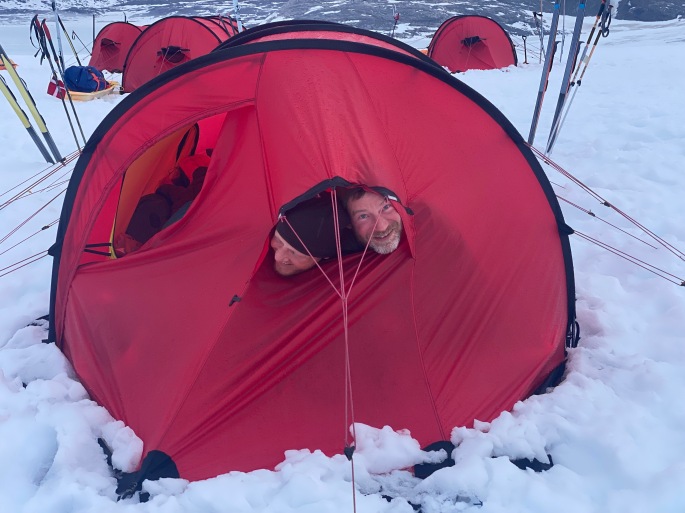
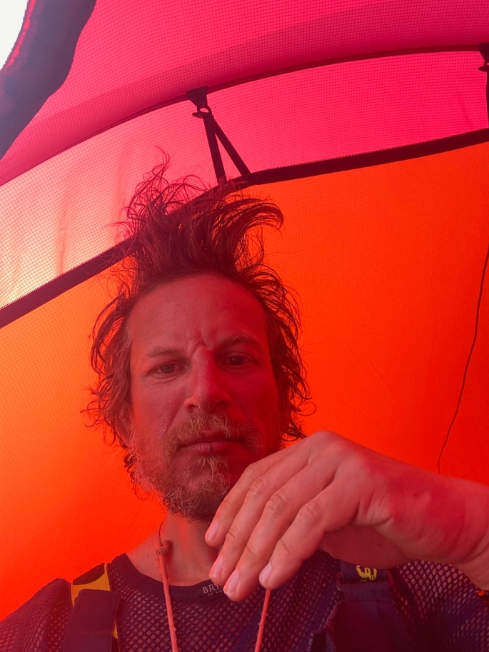
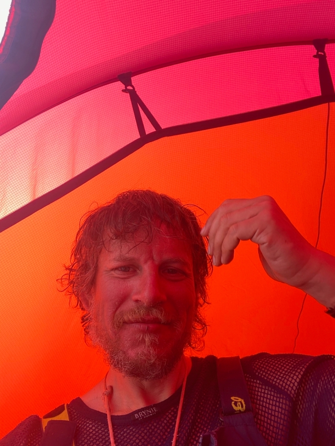
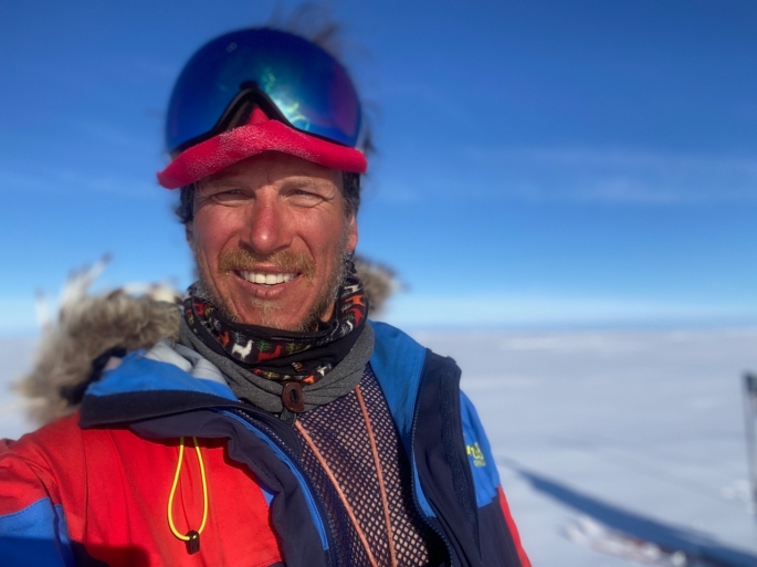
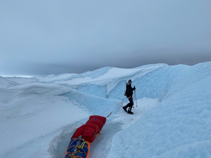
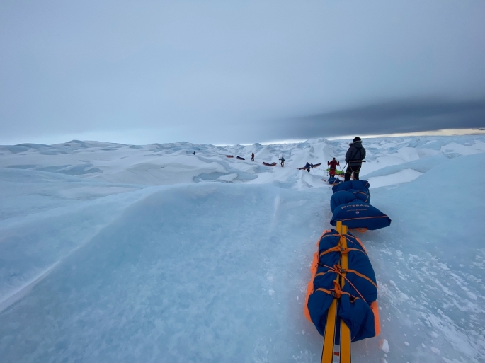
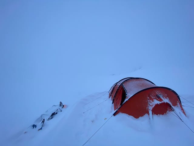
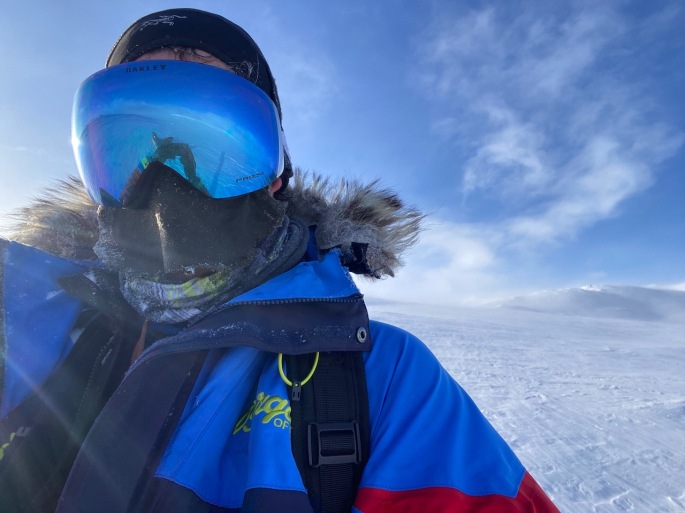
The whole experience was made even more amazing by the fantastic team we had with our group. Eight very different people who had not really known each other before the expedition – and it was absolutely tremendous!! Travelling across the ice, learning something new from everyone not just every day, but every hour… (especially with my dodgy “skiing” technique! hahah!)… facing the challenges together, working as a team to get through that rough icefall and move on over that ice. Enjoying good laughs and jokes together, and the lunches and dinners we were able to have as a group outside the tent when the weather permitted. Singing along as we skied – I will never forget our rendition of Bohemian Rhapsody as we sped along to the final glacier! And our tent-to-tent sing-along as we awaited the helicopter, really helping as we faced another night down there in the rain and gloom. I enjoyed every moment and the whole month was incredibly special. Everyone in the team helped make what was truly a tough challenge into something that almost seemed effortless and smooth… and completely unforgettable.

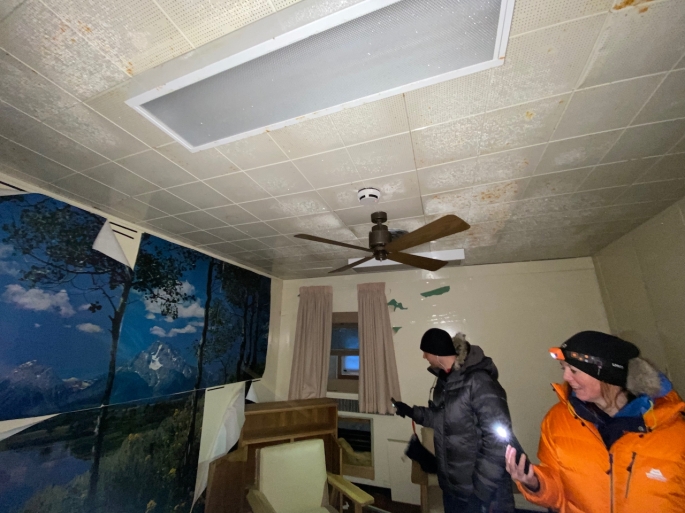
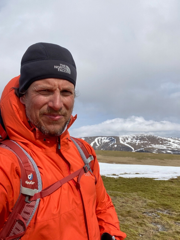
Back in the UK now, and it’s great being here, being in the warm and comfy bed! And coffee!!!! But I miss the ice, and I miss the team. Looking forward to getting back out there again, to staying in touch, and who knows, doing more expeditions with the team in the future!

Greenland Part 5: The final push

We were lucky with the weather and conditions over the full course of the journey. A couple of days’ worth of total whiteouts made navigation a little tricker, with some… interesting diversions from the main course witnessed… and also a couple of days with colder temperatures and stronger winds. Winds that meant we had to put our sleds parallel alongside each other rather than one behind the other as otherwise they just got blown upside down. One day saw a windchill factor of around -39C, making it slightly harder to ensure that our fingers stayed warm. I was pretty happy that managed to keep everything reasonably under control, though had to move from my lighter mittens to the big down-filled mitts to make sure that stayed okay as I could feel the fingers getting colder as we travelled. They took longer than what I would have liked to warm back up. On previous nights in the tent it had been warm enough to fire up the stove and eat without gloves, but our fingers quickly became numb when doing that as the temperatures plummeted. Definitely nice to get in the sleeping bag at the end of a long day!

Our daily distances started to increase further as we started the slow descent from 2,500m. The sleds had become lighter as we ate our way through our supplies and our best day was around 35km or so as we skied for around 11 hours. Fortunately, we didn’t have to have any other long days and we generally managed 30km or so on normal 9-hour days without too much effort. The plateau was so high, we couldn’t see any of the eastern coast mountains for many days as they were all much lower than where we were skiing. They only started to reveal themselves about two days or so before we reached the end. It was a big moment as we saw the first summit peaking up in the distance ahead of us. Then it was just amazing seeing more mountains appearing as we got lower and lower, and then seeing the coast and all the sea ice and icebergs floating their way calmly along through the water.

For the last night on the icecap we camped around 35km away from the end of the glacier at around 1,200m. We didn’t want to camp further down due to the risk of crevasses. We knew that snow was due to start mid-afternoon the following day so we started our final descent at 2am to have the best possible visibility. And it was stunning. Breathtaking views of the mountains on the other side of the glacier and the sun rising, and great skiing conditions. Before we knew it we had already completed 20km in time for lunch. Almost straight after we ate, however, we entered pretty dense cloud making it harder to see the best path, and we entered a maze of melt water channels that took a while to escape from. Narrow paths alongside deep chasms where the glacial melt water would flow as the temperatures increased; not places you would like to fall into. We tried to work our way through to a waypoint which had been clear on previous years, but it was impossible to see through the cloud and eventually we had to turn back and try a different way. Fortunately with the second route to a different waypoint, it became clearer and safer, and again it was full speed ahead and before we knew it, the end of the glacier and the end of our expedition was ahead of us… We had done it!!!

Only not quite..!

We were meant to get picked up by helicopter from that ending point but the bad weather meant that it was cancelled for three consecutive nights… frustrating!!! But we were able to make the most of it, despite it raining and being pretty miserable at the bottom, having sing-alongs between the different tents and relaxing as much as we could, with one of us always on polar bear watch (seeing polar bear tracks before arriving helped enforce the need for that!). It was difficult though after having been on the move for so long and having been looking forward to celebrating in Tasilaq where there was good food and drinks waiting for us. For the third night, rather than staying put yet again, we decided to ski down to the fiord and on to the sea ice, up to the edge of the water, and were picked up by boat. It wasn’t possible to go to Tasilaq but they took us to Isertoq where it was nice to actually have a night inside and celebrate the journey before getting finally picked up by the helicopter in the morning. This time, we had done it!

Greenland Part 4: Leaving DYE2 behind

After DYE2 we had a few more days of skiing slowly uphill before it was pretty much flat for a while, and we eventually started the slow and almost imperceptible descent towards the eastern coast.

We had mixed weather conditions, with some whiteouts, some windier days, and some hotter and colder conditions. I have talked about it in another post but… I have to mention it again… whiteouts are really quite tough and surreal! The last time I had dealt with them was in Norway. At least there every now and then you could see rocks in mountain-sides, which helped a little, helping you feel like you are actually getting somewhere. But this time, nothing. Everything white: above, below, and beside you. Absolutely nothing to see for reference and a true limbo, in which you feel like you are floating; moving but going nowhere at the same time. With the temperatures, the worst it got down to was around -39C with the windchill, making it harder to control the temperatures in our extremities with the fingers and toes. But we all came through alright. On one of the hotter days, with temperatures around -1C or higher, clumping became a problem with the skis, as did over-heating, making life really hard. We had to stop for an early an extended break to wait for the temperatures to cool down–and it was remarkable: just one or two degrees difference and the clumping just stopped.

We went 13 days without a break from the start so took a rest day on which it was great to sit with the group and have lunch outside. Our guides, Elisabeth and Calle, prepared a treat for us all with pancakes and soup; a brilliant surprise! A few days later after more travelling, we also took a weather day because of the strong winds, but we had made good progress so it was fine and we were still going according to plans and schedule with the timings to get to the other side. When we got going, we had a day when we saw another expedition–almost right in the middle of the icecap. It was quite an exciting moment for all of us considering how we hadn’t seen anyone for a while. We first saw their silhouettes on their ice in the distance and took a while trying to work out what they were as we approached. They were coming from the other direction, from east to west, and both of our groups veered slightly away from our courses so we could meet and chat for a few minutes before continuing on our journeys. They were from Iceland and had taken 20 days to get as far as they did. When we finished the expedition, we flew to Iceland and apparently they were local celebrities and people we met asked us about them. They might have taken a few more days, but made it eventually which was great to hear.

As the plateau is so high we were unable to see any of the eastern coastal mountains until the last couple of days of the descent. Our eyes were constantly looking to the horizon, scanning for signs that we were getting close to the end, though the icecap would give very few clues to what awaited us…

Greenland Part 3: Relics of the past…

As we sped across the ice, and left the western mountains and the icefall behind, we spotted the DYE2 abandoned radar station from around 28km away. A small black spot on the horizon that gradually loomed larger and larger as we got closer over the next day and a half. It provided a nice reference point for navigating – a welcome change from constantly looking at the compass and looking for snow patches that stood out in the distance to help us maintain straight lines. I didn’t know what to expect though it was undoubtedly one of the highlights of the journey.

DYE2 was one of a network of over 60 radar stations built by the US across Canada and Greenland to provide early warning against possible missile attacks by the USSR during the Cold War. It was abandoned in 1988 as the Cold War came to an end and the technology was pretty much obsolete. It has just been left to the mercy of the elements since then. It felt like quite a milestone to get there and was a real sign of the progress we had made. It was difficult gauge how tall it was as we approached. We thought it must have stood around 30m above the ice but then as we slowly but surely got closer we could see how the snow and ice had built up around it and there was at least another 20m or so that had been obscured by the drifts that had accumulated since the facility was abandoned. It felt like quite a milestone to get there and was a real sign of the progress we had made.

Once we finally arrived, we looked for ways to get in. Morten Obel found one, walking on a roof that was easily accessible from the snow, to reach an open doorway. It was like a museum. Some rooms had been filled with snow over the years as the weather took effect, while other rooms were in really good condition, as if people just disappeared a few weeks ago. Various documents with instruction manuals for the running of the facility. Magazines and sofas, as if people just upped and left; very spooky in many regards – could definitely imagine it being a great setting for a horror movie or series as we went through it with their flashlights! Rooms where other expeditions had actually stayed after they got caught there in bad weather. A poignant moment was seeing a mock trip advisor review written on the walls of one of the bedrooms, signed by members of an expedition team that had been pinned down at the station for five days due to fierce storms in May 2021. One of those was “Dixie”, who we later realised was Dixie Dansercoer, a Belgian explorer who died just a month later on 7 June 2021 while on a south-to-north kiting expedition across Greenland, after falling into a crevasse. A tragic death of a great adventurer.

We managed to make our way to the radar dish inside the dome at the top, from where we were able to get amazing views of the icecap in all directions. Klaus brought some schnapps with him as a surprise for all of us to celebrate the moment. The view was fantastic but at the same time it was pretty much the same in all directions accept for a nearby ice runway and small airbase. Still plenty more travelling to do over the next weeks!

Greenland Part 2: Speeding up…

We started the expedition off slowly: three 50 minute sessions on the first half day with 5km travelled, then doubling to six sessions on day 2. Following this we added an extra session each of the next three days, until we were travelling nine sessions over the course of each day. We didn’t want to go all-out straight away due to risk of injury and we wanted our bodies to adapt to the demands of the expedition. While we had all been training hard, it was still important to be careful.

At the same time, the terrain of the icefall didn’t allow us to move very fast as we were snaking around and looking for the best ways through for quite some time. Indeed, we took three days to get through this part of the challenge: the ice ridges slowly became less prominent, the chasms became shallower and the crevasses became fewer and farther between. It turned into an undulating landscape of smooth snow and ice in all directions. As the landscape changed, our speed increased: more than doubling from 8km travelled on day 3 to 18km on day 4 and increasing up to 24km by day 6.

It would be easy to describe the terrain as featureless but that would be unfair: the glorious weather and the sun sheds all sorts of characteristics to the ice that help catch one’s attention. And we had wonderful weather with bright sunshine, clear skies, and temperatures that hovered around -10C for a good week or so. The conditions were so good, we were skiing in our base layers, and even able to have a dinner as a group outside of the tents on one of the nights! In these conditions, the randomly scattered rougher and exposed ice could be clearly seen, making navigation straightforward as we could use them as reference points for our headings. At the same time, the eyes could play tricks: we could see what looked to be steep snow walls in distant hills though as we got closer, the slopes were barely noticeable. As an added bonus – we even saw a flock of geese migrating west on one of the earlier days. Just imagine the distance they have to travel!

It was quite amazing and a privilege being in the middle of all this; the serene and pristine environment that just took our breath away. Being here and the mind also goes on its own journeys as we listened to the sound of our breathing and the skis. It’s tough, but it’s all so peaceful at the same time.

Greenland Part 1: The icefall

The weather as we started was positively mild – around 5C at the bottom of the icefall at point 660, the starting place of pretty much all west-east Greenland expeditions around 90 minutes’ drive outside of Kangerlussuaq. 660 metres above sea-level – we knew we would have to slowly pull our 80kg pulks up to around 2,500m over the next couple of weeks before descending on the other side of the icecap. We were a little worried about whether the ice would be good and solid enough to ski on at the start, or whether we would have to carry the pulks over the moraine up to the glacier. Fortunately, while it was wet, we could still ski across the first few kilometres, saving a lot of time.

Progress was slow. The icefall is where the ice from the glacier leading up to the icecap descends down and crushes against the land, melting and fracturing as it comes to an end. The huge pressures and the warmer climate melting the ice create a maze of ice ridges, deep chasms and crevasses that await any adventurer making their way up. We were fortunate in that we had good visibility all the time we were on the icefall so we could work out a way through it all – had it been whiteout conditions it would have been a complete nightmare and we would have all had to be roped together in case anyone fell into any of the traps around us. Our guides, Elisabeth and Calle, were able to go ahead to try see the best route – it always seemed that as we got closer to the other side of the various ridges, we might be greeted with flatter ice to ski over… but no. On the other side of each ridge, there were just more ridges, more chasms and more challenges!

We all had to work together to make sure we got through alright: The pulks were at their heaviest, laden with food and fuel supplies for the next four weeks, and they would do their best to drag us back down the ice, or run into us as we went over ridges and down the other side. A lot of fun for sure, and it was good working our way through everything, but very limited with the distance we could go. We must have averaged around 6-7km those first three days. It was a relief as we got closer to the top and the ice gradually smoothed out and from then it was a matter of full speed ahead!

Greenland – Final countdown and preparations

March-April 2022

With all the fitness training over the past few months, time really did seem to fly by to the end of April when we eventually started the journey across the icecap. So long in the waiting, but still always training as much as possible to be in the best possible shape for the journey; trying to squeeze in as much as possible but not to overdo it. More mountains climbed in Scotland, plenty more tire-pulling and lots of strange looks from people. Braeriach, the third highest in the country, is always an amazing mountain to climb and is quite accessible for me from Carrbridge, and it becomes even more stunning with the snow. Also, an opportunity to climb Ben Nevis in winter could definitely not be missed and it was nice climbing the UK’s highest mountain in cool and lovely conditions.

Before we knew it, the time had come. 25 April: Inverness to London, to Copenhagen. 26 April: Copenhagen to Kangerlussuaq. Always that anxiety about whether the bags would come through–imagine that! One flight to Kangerlussuaq every couple of days… no, it was too terrible to think about…! Fortunately they all came through and no problems. It was great in Copenhagen with the hotel being next to the airport – could take the trolley from the airport all the way into the hotel room; not seen that before! Quite a change from Oslo when there are barely any trolleys at the main railway station!

We had one night in Kangerlussuaq to organise all of our supplies for the next four weeks, splitting everything into weekly bags and sorting out the pulks. Had a bit of a scare when realised that I didn’t have my mountaineering harness, which we need for going through crevassed areas. Almost a disaster, though fortunately we we were able to find one from a local guide – such a relief! Then that was it… just a bus ride to the bottom of the glacier on a gloomy and overcast early afternoon of 27 April, and we were off…

Traveling through whiteouts

Some of the most intense days when skiing on the Hardangervidda plateau were spent skiing through whiteout conditions. Whiteouts are when you can’t tell the difference between the snow beneath your skis and the sky. Whiteouts are not necessarily blizzards, and indeed, blizzards are often incorrectly called whiteouts. More often you will be travelling over the snow through fog or cloud. You might be able to see dark objects like rocks in the terrain, but that will be about it. Travelling through a whiteout is like travelling through limbo: you feel like you are moving yet going nowhere. Nothing seems to change. There are no shadows and there is no contrast. It can be disorientating and strangely claustrophobic at the same time. If you’re not prepared, it can be dangerous, no matter where you are.

Skiing through such conditions can be tricky enough even on flat snow as navigation becomes much harder. If you are lucky, there will be some rocks, and you can use them to help with the navigating, though these can easily disappear from view, behind a small hill or in even denser cloud. The rocks can be deceptive as well as you have no sense of scale; they might be small rocks close to you or larger rocks further away. There could easily be a few small hills or large snowdrifts between you and the rocks as well, but you won’t know until you reach them because they are covered in snow so are indistinguishable from anything else. You will need your compass and GPS – even better if you got a compass mount so you can have the compass extended in front of you without having to hold it in your hands, so you can constantly see your heading. Failing that, if there is wind, you will feel the direction from which it is coming in general. Then you can use that as a navigational support: if you’re heading north and you have an easterly wind, for example, keep it so it’s hitting you from the right.

Going up or downhill, or across sastrugi where the wind has cut through the snow to create those amazing ice sculptures beneath your feet, is even trickier. Especially with an 80kg sled behind you. Yes, you will have your compass and GPS, and you will know your general heading. But the maps will only show so much; the contours will most likely measure 20 metre differences in the terrain but nothing more detailed. Snowdrifts and slight dips and small mounds aren’t shown and you can’t keep looking at your GPS anyway, especially as battery is a consideration. Even when armed with your heading, any undulations through the snow will be invisible. It is impossible to see where the snow is steepest and work out the best route up. You might be struggling up a steep climb one moment, inching your way up, but then you suddenly come to a dip in the snow and before you know it, you are skiing down into a small dip. Maybe a frozen rock pool or hidden stream beneath the snow or some other feature. And your sled hurtling down the slope behind you…

I found myself slowly zig-zagging my way up and down the hillsides, especially with the sled being pretty heavy. Keep calm and keep breathing. Judge the feeling of the snow beneath the skis, the pull of the sled on the harness getting heavier and lighter as the terrain changed. The general balance and feel. It was slow, often painful, and challenging–especially when the snow got really deep–and there were points when it just seemed the climb would never end; going into that endless white void.

But then it gets flat again and you realize that the hardest parts are behind you and that you managed it. And you keep going.

Norway training Part 2: Preparing for Greenland and South Pole

With the ending of the group training with Hvitserk, I took the opportunity to go on my own solo journey around the Ustaoset and Finse region, and up to the Hardangervidda Plateau. With the South Pole plans at the end of the year, I aim to travel solo, so I need to have as much experience out by myself as possible. The journey to the Pole is not just physical, it’s also psychological – travelling alone for around 50 days, in the most extreme conditions, pulling the heavy weight of the pulk the entire time; the routine… every day, getting up, breakfast; packing up the sleeping bag and tent… skiing for the next eight hours or so… pitching the tent again; firing up the stoves and heating the water for food. Dinner and then sleep. And repeat. With nobody else around; just the satellite phone and locator beacon as your only means to contact the outside world a thousand miles away.

The Hardangervidda Plateau is a tremendous place to train. While the terrain is different from Antarctica – you have to ski through mountain passes and the wind is quite variable – the conditions can be formidable. I had a couple of storms with winds reaching around 70mph or so, and plenty of days with just constant strong headwinds. Then there were the whiteouts (I will write a separate post about them as you can say so much!!!), and travelling through deep snow, going up to your knees even with skis on that are meant to distribute your weight… and the climbing… It was tough! At the same time, with the tough conditions, Norway is wonderful because there is such great infrastructure. UT.no is a superb site that shows all the winter and summer trails (not in English, but it is easy to work out), and it also shows cabins where you can stay. You can use the site to easily plan out the routes you would like to take. From around early February people go out on their snow-mobiles to mark out the trails with long thin branches plugged into the snow as well, which would help anyone out there. The cabins were not open when I was there but if you join the DNT – like the backpackers association in the country (their website is also in English) – they give you a key that you can use to access the cabins in emergencies.

The second night out, I made a mistake with the tent in incredibly strong winds which led to some of the poles breaking… it was stupid of me, but I know what I did wrong and after repairing everything, it was nice for the confidence to be able to put the tent up again in similar conditions with no problem. Still hard when by yourself… so much harder than when with other people… but it’s something that I will have to deal with constantly in Antarctica. I won’t be able to just stay in the tent when it is windy – the winds will be merciless there! So ultimately, it was good to make the mistake in Norway where I could mend things and recover, to keep going. And ultimately, learn from what happened. It was a great feeling to arrive at Finse at the end of the time on the plateau having been able to work, navigate and travel through all those conditions, and it certainly helped build the confidence enough to know that with continued training, I’ll be able to manage on Antarctica. Exciting just to think about!!