Greenland Part 2: Speeding up…

We started the expedition off slowly: three 50 minute sessions on the first half day with 5km travelled, then doubling to six sessions on day 2. Following this we added an extra session each of the next three days, until we were travelling nine sessions over the course of each day. We didn’t want to go all-out straight away due to risk of injury and we wanted our bodies to adapt to the demands of the expedition. While we had all been training hard, it was still important to be careful.

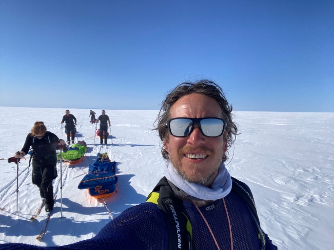
At the same time, the terrain of the icefall didn’t allow us to move very fast as we were snaking around and looking for the best ways through for quite some time. Indeed, we took three days to get through this part of the challenge: the ice ridges slowly became less prominent, the chasms became shallower and the crevasses became fewer and farther between. It turned into an undulating landscape of smooth snow and ice in all directions. As the landscape changed, our speed increased: more than doubling from 8km travelled on day 3 to 18km on day 4 and increasing up to 24km by day 6.

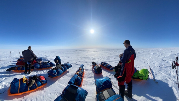
It would be easy to describe the terrain as featureless but that would be unfair: the glorious weather and the sun sheds all sorts of characteristics to the ice that help catch one’s attention. And we had wonderful weather with bright sunshine, clear skies, and temperatures that hovered around -10C for a good week or so. The conditions were so good, we were skiing in our base layers, and even able to have a dinner as a group outside of the tents on one of the nights! In these conditions, the randomly scattered rougher and exposed ice could be clearly seen, making navigation straightforward as we could use them as reference points for our headings. At the same time, the eyes could play tricks: we could see what looked to be steep snow walls in distant hills though as we got closer, the slopes were barely noticeable. As an added bonus – we even saw a flock of geese migrating west on one of the earlier days. Just imagine the distance they have to travel!

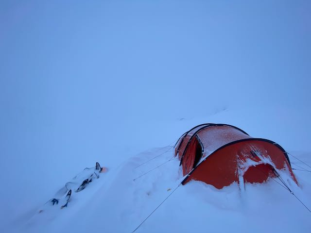
It was quite amazing and a privilege being in the middle of all this; the serene and pristine environment that just took our breath away. Being here and the mind also goes on its own journeys as we listened to the sound of our breathing and the skis. It’s tough, but it’s all so peaceful at the same time.

Traveling through whiteouts

Some of the most intense days when skiing on the Hardangervidda plateau were spent skiing through whiteout conditions. Whiteouts are when you can’t tell the difference between the snow beneath your skis and the sky. Whiteouts are not necessarily blizzards, and indeed, blizzards are often incorrectly called whiteouts. More often you will be travelling over the snow through fog or cloud. You might be able to see dark objects like rocks in the terrain, but that will be about it. Travelling through a whiteout is like travelling through limbo: you feel like you are moving yet going nowhere. Nothing seems to change. There are no shadows and there is no contrast. It can be disorientating and strangely claustrophobic at the same time. If you’re not prepared, it can be dangerous, no matter where you are.

Skiing through such conditions can be tricky enough even on flat snow as navigation becomes much harder. If you are lucky, there will be some rocks, and you can use them to help with the navigating, though these can easily disappear from view, behind a small hill or in even denser cloud. The rocks can be deceptive as well as you have no sense of scale; they might be small rocks close to you or larger rocks further away. There could easily be a few small hills or large snowdrifts between you and the rocks as well, but you won’t know until you reach them because they are covered in snow so are indistinguishable from anything else. You will need your compass and GPS – even better if you got a compass mount so you can have the compass extended in front of you without having to hold it in your hands, so you can constantly see your heading. Failing that, if there is wind, you will feel the direction from which it is coming in general. Then you can use that as a navigational support: if you’re heading north and you have an easterly wind, for example, keep it so it’s hitting you from the right.

Going up or downhill, or across sastrugi where the wind has cut through the snow to create those amazing ice sculptures beneath your feet, is even trickier. Especially with an 80kg sled behind you. Yes, you will have your compass and GPS, and you will know your general heading. But the maps will only show so much; the contours will most likely measure 20 metre differences in the terrain but nothing more detailed. Snowdrifts and slight dips and small mounds aren’t shown and you can’t keep looking at your GPS anyway, especially as battery is a consideration. Even when armed with your heading, any undulations through the snow will be invisible. It is impossible to see where the snow is steepest and work out the best route up. You might be struggling up a steep climb one moment, inching your way up, but then you suddenly come to a dip in the snow and before you know it, you are skiing down into a small dip. Maybe a frozen rock pool or hidden stream beneath the snow or some other feature. And your sled hurtling down the slope behind you…

I found myself slowly zig-zagging my way up and down the hillsides, especially with the sled being pretty heavy. Keep calm and keep breathing. Judge the feeling of the snow beneath the skis, the pull of the sled on the harness getting heavier and lighter as the terrain changed. The general balance and feel. It was slow, often painful, and challenging–especially when the snow got really deep–and there were points when it just seemed the climb would never end; going into that endless white void.

But then it gets flat again and you realize that the hardest parts are behind you and that you managed it. And you keep going.